
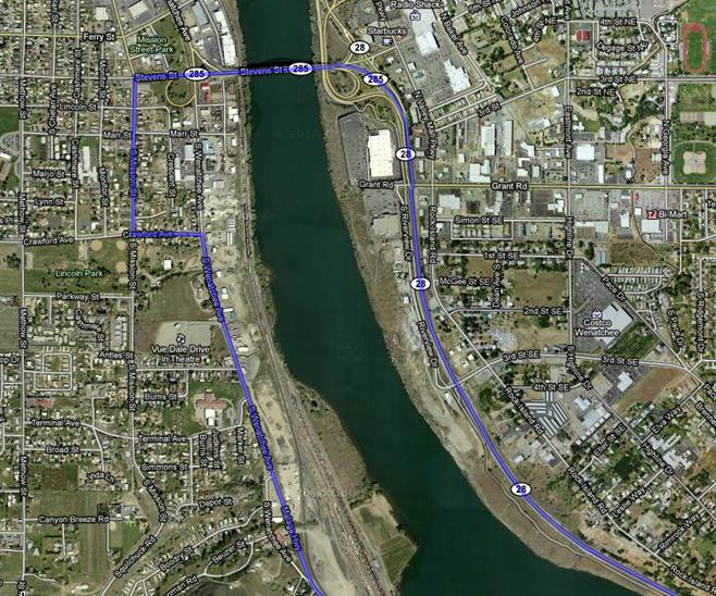
From Southeast & East of Wenatchee
| 1. Slight left at WA-285 N, stay in left lane across Columbia River | 0.7mi |
| 2. Turn left at S Mission St | 0.4mi |
| 3. Turn left at Crawford Ave | 0.2mi |
| 4. Turn right at S Wenatchee Ave | 0.6mi |
| 5. Continue onto Malaga Hwy | 5.1mi |
| 6. Continue on Malaga Hwy, becomes Malage-Alcoa Hwy | 3.2mi |
| 7. Veer right at fork (Y) onto Colockum Rd – look for the signs “Colockum Natural Resource Center” | 10.0mi |
You are traveling along the Columbia River, headed south until the Y; at that point you move west away from the river and gain altitude.
Total Trip just over 21 Miles.
From Wenatchee
Begin on South Wenatchee Avenue, just past the Sellar Bridge overpass.
Follow #5-7 Above. Total Trip = 20 Miles from the overpass.
