Volume 12 Issue 4
Cool-weather has continued despite the seasonal switch to spring in late March. According to the National Phenology Network – Status of Spring, the West Coast of the US is far behind an average year with the Southeast much further ahead than an average year. According to the Network, plant development like we have seen thus far happens every 1-4 years. In Northwestern Washington plants are behind but can quickly push ahead once heat units begin to pile up. To put this year in context below is some data from WSU AgWeatherNet.
Temperature
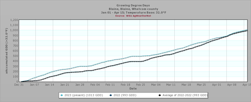
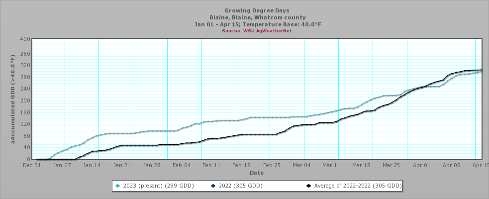
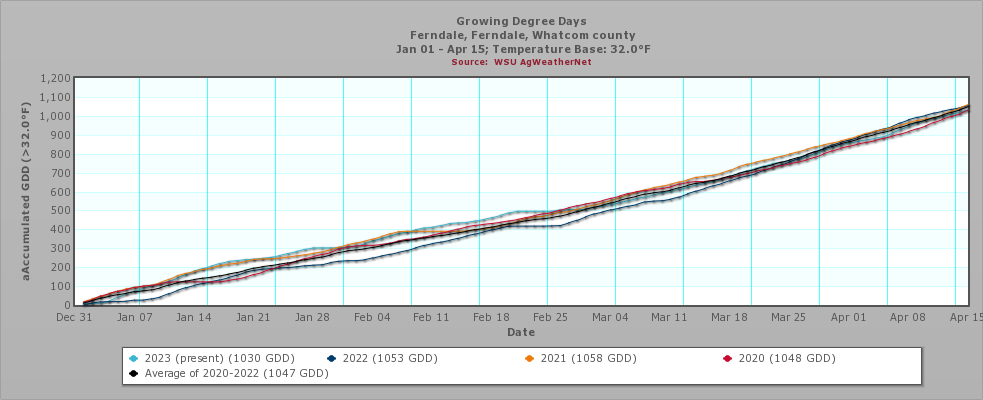
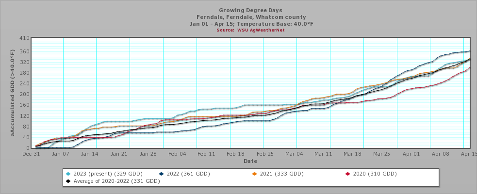
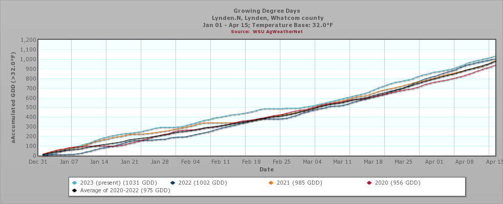
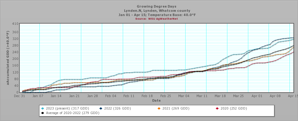
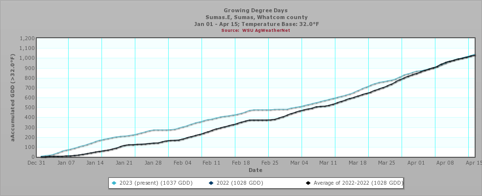
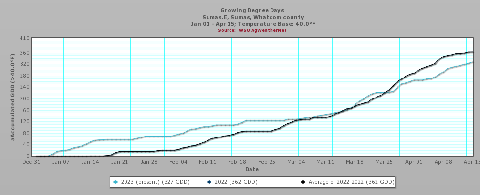
On average for the county, 2023 is looking very much like 2019 when it comes to temperature. But a closer look at individual stations showed that some have considerably lower growing degree days (GDD) (base 32F) thus far. Using 40F as a base, 2023 looks a lot like 2020 and 2021.
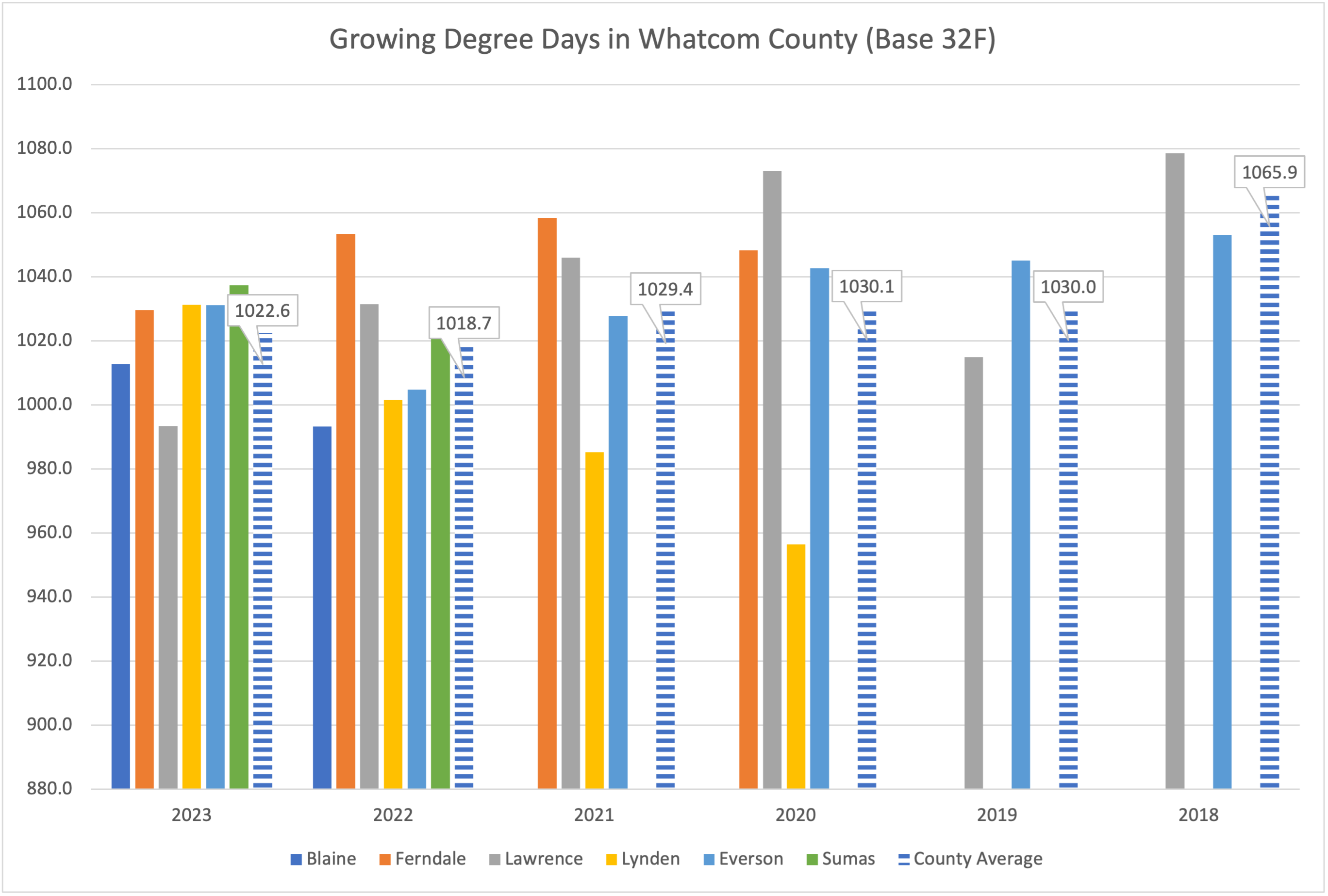
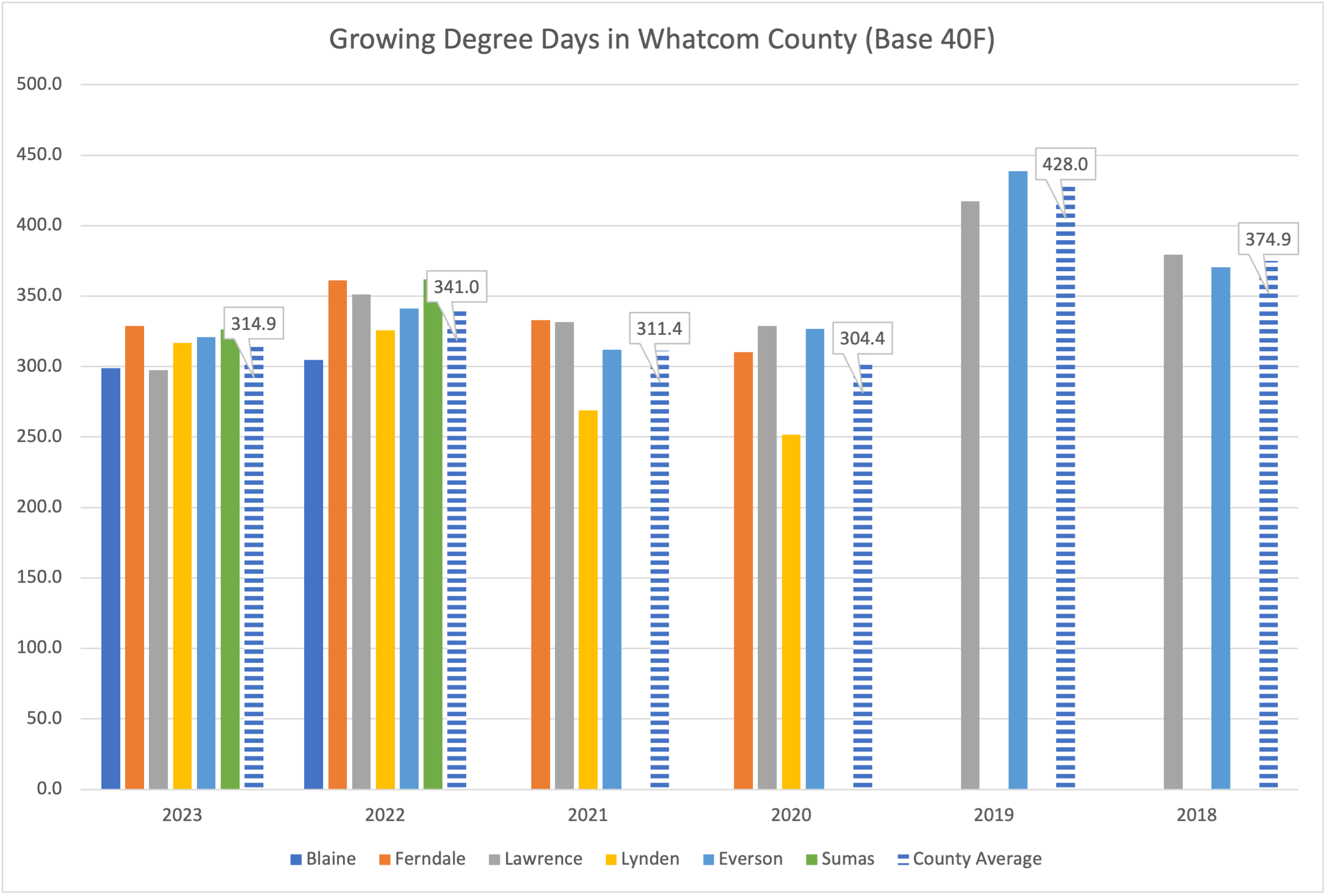
By looking more closely at individual stations and comparing GDD (base 32F vs 40F) what we find is that far fewer GDD have accumulated in 2023 because temperatures did not push above 40F for extended time periods (NOTE: Data was not available for Lawrence and Nooksack stations).
Blaine Weather Station
Ferndale Weather Station
Lynden North Weather Station
Sumas Weather Station
Precipitation
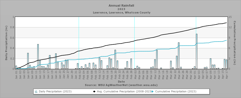
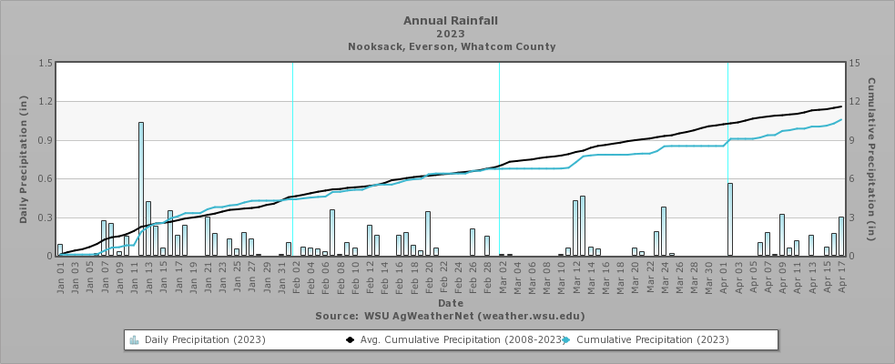
While GDD appear to be lower than average, cumulative precipitation since Jan 1 is down 5 inches (Lawrence station) or 1 inch (Nooksack station).