Volume 11 Issue 4
When I began to assemble this article, I looked at the weather summary article from last spring that outlined a below average accumulation of Growing Degree Days (GDD) coupled with very dry conditions. This spring appears to be a bit different with the same cool conditions, but with what seems like a lot more precipitation than normal, but how much different is it?
Temperature
2022 has started much much cooler than the average for the Lawrence and Nooksack WSU AgWeatherNet stations (these stations have been logging data back to at least 2016, while the other stations in the county have only been online since 2020 or more recently). The data presented here is GDD for both a base of 32F and 50F to outline the differences in our daily highs between the years. Averaging across the two stations we can see that 2022 has accumulated 13% and 82% less GDD units for 32F and 50F bases, respectively. What this means is that 2022 is significantly behind on temperatures above 50F more so than temperatures above 32F.
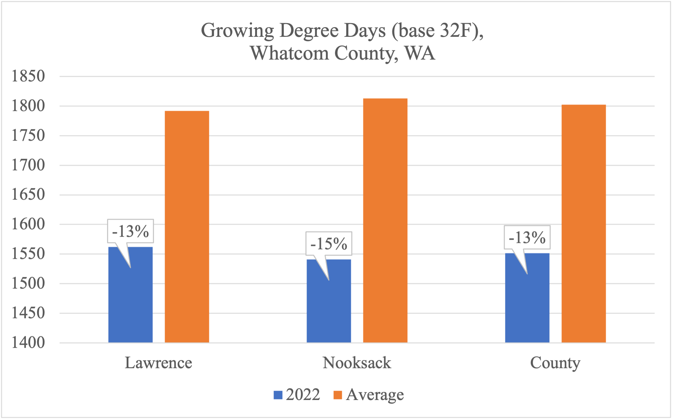
Figure 1. Accumulated growing degree days (GDD) base 32F for weather stations in Whatcom County, WA.
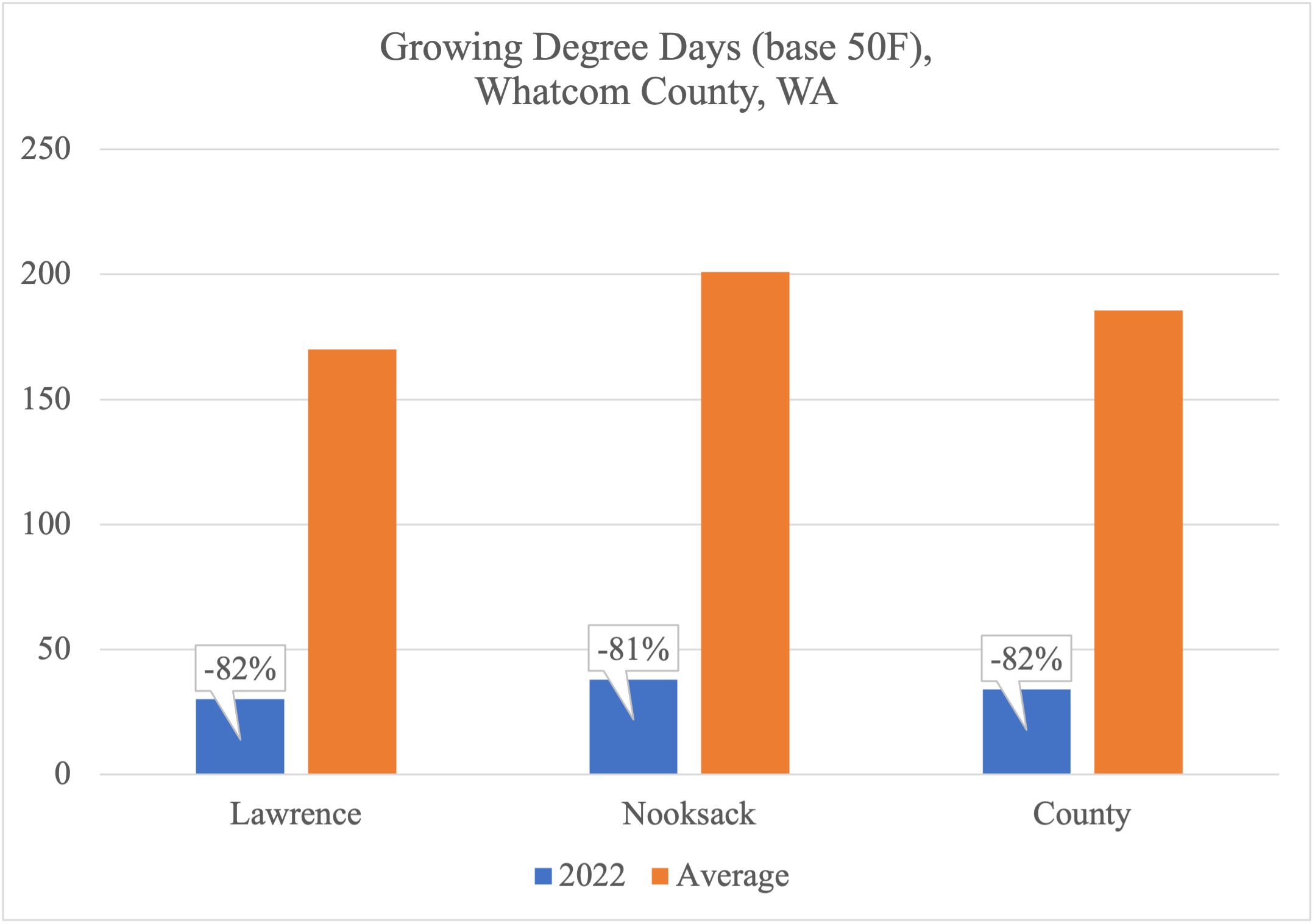
Figure 2. Accumulated growing degree days (GDD) base 32F for weather stations in Whatcom County, WA.
Precipitation
Through much of February, most stations recorded below average precipitation (Fig 3). The Lawrence and Nooksack stations have been in place the longest and allow us to look at longer term trends. For the Lawrence station, accumulated precipitation passed the 2018-2021 average in late January then dropped below it until early May. For the Nooksack station, it was on January 11 that accumulated precipitation levels jumped above the 4-year average and has stayed there through the end of the evaluation period of May 16, 2022. We don’t have longer term historical data for the other stations as they are new or have been removed. But simply discussing geographically, it appears that precipitation has been heavier further South and East in the County since January.
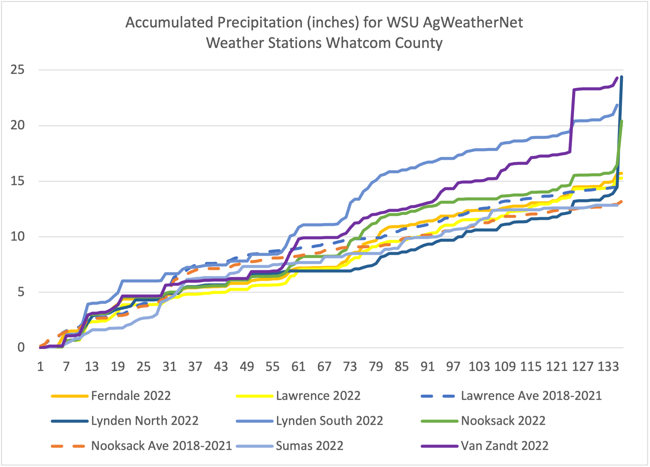
Figure 3. Accumulated precipitation for weather stations in Whatcom County, WA.
Now where do we go from here? This is where the law of averages and several long-term weather forecasts are at odds. The former would suggest a significant warm up with dry conditions and the latter has predicted a cooler than average summer with brief periods of precipitation.