Welcome!
This webpage contains many links and resources that club leaders and teachers can use as activities to teach young people about GPS and GIS. You can easily learn a lot about it yourself, too! The majority of resources are geared for teaching middle school (4-H Intermediate) and high school (4-H Senior) youth. By no means is this an exhaustive list of the resources available. Here you will find clear and simple explanations, (usually animated) and added additional material for engaged learners. The links and resources are ordered sequentially to add more knowledge to that which has already been acquired. The two components GPS and GIS are each sorted into achievement levels. Feel free to use whatever works for you and your youth!
Several of these sites require a media playing programs you may need to download in advance.
GPS Objectives:
• Introduce young people to the Global Position System and learn how it works
• Learn about different units of measurement used in global navigation
• Practice using GPS receivers and traditional navigation tools in the field though fun activities
• Learn how GPS is used in a variety of occupations, and how it works with GIS
GIS Objectives:
• Introduce young people to Global Information Systems through online exploration
• Understand the significance of data: its collection and uses
• Develop critical thinking skills in data analysis via the use of projected maps
• Devise relevant models of application that can be exercised in their own community
Why Should We Pursue this Project?
It’s science, geography, critical thinking, it’s visual, it’s active and it’s fun!
As quickly as we discover the interdependence of living systems, science defines vast areas of specialized knowledge. Bringing our vast fields of knowledge into a system where they can be analyzed and considered simultaneously, is one mission of GIS. Ours is now a global society and scientists, researchers and surveyors of every kind are collecting data everywhere. GIS is a tool that will help us make sense of the many layers of interaction taking place around us.
Beyond science and discovery, GPS/GIS are already used in ever facet of our lives, to manage power grids, sewer systems, cities, people and data. GPS and GIS are tools that are fast becoming a standard in most industries. The job market of the very near future will recognize people with applicable skills and knowledge in this field.
Finally, for young people these days, knowledge of the world around them is essential for success. 4-H promotes engaged citizens, and citizens can not be well-engaged unless they are well-informed. Research, critical thinking and problem solving are real skills that are the cornerstones of an effective GPS/GIS project.
The GIS Internship
4-H offers GIS Internships to advanced youth (usually high school juniors and seniors) in Whatcom County. It includes several hours of online instruction and GIS software. The expectation is that the youth provide their mapping skills to their communities, schools or clubs.
For more information about the GIS internship contact: Michael Wallace (360) 778-5813
4-H GIS Internship Brochure (pdf)
Community Work
Ideally, after youth learn about GPS and GIS, your goal should be to engage their skills in their local community.
This might include the following activities:
• Invite a guest GIS professional
• Request permission to add to a current body of scientific data
• Choose data to gather that matters to the youth and determine how it can be mapped.
• Collect and share data in the form of a map with your local government or public issues group
GPS Resources
4H Preparing the Garmin for Data Collection:
4-H Getting to Know the Garmin Rino 120:
4H The Art of Setting and Finding a GPS Waypoint:
Middle / Intermediate
• Outdoor Navigation with Map and Compass
• Introduction to Latitude and Longitude
• Trimble Slideshow: How GPS Works
• “Find Your Longitude” Nova Game
• How GPS works online activity
• How to Use a GPS (Helpful Hints)
High / Senior
• How Do Map Projections Distort Earths Surface?
Important information since GIS tools can select from several projection types.
• ESRI Video On GPS to GIS
Right click link, save to your computer, then play with Media Player
• Moving Points from GPS to GIS
• ESRI Creating a Map from X, Y Coordinate Data
• How do Latitude and Longitude Coordinates Help Us See Changes in the Earth?
• Using Garmin with Paper Maps
Advanced
• From Star Gazers to Starships – Chapter 5 – Latitude and Longitude
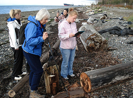
GPS Activities
The Whatcom County Extension Office has 4 GPS Garmin Rino Units available for two-three day loan to local 4-H clubs or school groups. For more info, please contact Michael Wallace.
• Map Datums and Coordinate Systems
• Preparing GPS Receivers for Group Activities
• MJC GPS Field Exercises
• GPS Glossary
• www.geocaching.com
Special Thanks to Mike Clifford, 4-H Leader in Virginia for the above documents.
Science Surfing (Cool Sites and Directories)
• Mr Davies Science and Education Links
• Exploring Earth – an online interactive learning lab
GIS Resources
There are a plethora of GIS based maps now available on-line. A good place to begin is the Google Earth download. Youth could spend days exploring the planet and cultures in great detail through this tool.
Middle / Intermediate
• What is GIS? – ESRI Intro
• Beginning Activities Exploring GIS – includes a software download
• Examples of Data Maps
Use still data maps to encourage critical thinking in youth. What do the maps show? What questions do the maps raise? What conclusions can be drawn?
What is data? How do we measure? What do we measure?
Interactive Maps
• Navigation Basics (pdf): Most interactive maps will have the same set of tools. This worksheet, paired with the websites below, will give youth a chance to discover what each tool does.
Studying Relationships
Have students choose from some of the interactive maps below to draw and redraw maps with different layers. (when applicable) Ask them to develop a hypothesis based on what they see in the layers they join.
• NOAA Data Center – Map Viewers
• Department of Ecology Databases
• U.S. Census Fact Finder
Once you are familiar with the concepts, here is a great tool for Middle School students:
Arc Explorer Java Edition for Education
High / Senior
What is GIS?
• USGS Intro
• ESRI Website
• ArcGIS online map
• Geospatial Platform
Exploring Data
The more you delve into using GIS the more you will need data. Many websites now store, manage and project data. This University of Wisconsin webpage is full of useful data source links. Create a profile of your community.
Advanced
• University of Washington Nature Mapping