
![]()
ENGAGER – Skill Level: Two
Title: Turbidity; What You Can’t See
Activity 1: Modeling Turbidity
Objective: Create turbidity in a jar and observe the behavior of soil particles in water.
Science Skills: Observation, Compare/Contrast, Infer
Life Skills: Critical Thinking
Materials
- A clear jar with a tight sealing lid
- Small shovel
- Soil
- Water
Day 1:
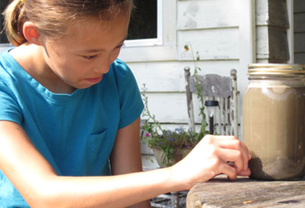
- Fill a jar about 1/3 of the way with soil. Add water (tap water is fine) leaving about 1 inch of space at the top. Put the lid on and shake vigorously for five minutes. Stop shaking and look at the water. Notice the color and the particles floating in it.
Asking the Right Questions
Have you ever seen a river or stream that looked like as cloudy as this?
What do you think could have caused it to look this way?
Do you think it would be harder or easier for plants to grow in cloudy water or clear water? Why?
Do you think it would be harder or easier for fish or insects to live in cloudy water or clear water? Why?
2. Place the jars somewhere they won’t be disturbed for 24 hours.
Day 2:
After 24 hours carefully, so that you don’t stir the sediment up again, examine your jar of soil and water.
Asking the Right Questions
Examine the particles on the bottom of the jar. Do you notice any thing interesting about how the particles have settled? Do you think the difference in the sizes of the particles affected how long they took to settle? Why are some areas of a riverbed rocky while other parts are sandy or silty?
Activity 2: Measuring Turbidity
Activity: Measure turbidity of water samples drawn from a local stream.
Objective: Learn how to measure turbidity and learn about the condition of a local stream.
Science Skills: Measure, Collect Data, Use Tools, Hypothesize
Life Skills: Keeping Records, Marketable Skills, Personal Safety, Critical Thinking
Preparation Activities: See Explore More for digital or print resources of topographical maps. Obtain a topographical map of your area. These are available at many camping stores or online from the US Geological Survey You can also use a free online mapping website such as Google maps. You can “fly over” your watershed you can download Google Earth to your computer. (View the “Navigation Beginner Tutorial” if you are unfamiliar with Google Earth.) WSU Whatcom Extension also has tutorials on creating maps using GIS.
SAFETY FIRST
Your safety is the most important factor to consider when you choose a site to visit. If you cannot locate a safe place to visit your local stream, please don’t do it! And, please, never try to sample water from a stream during a rainstorm or anytime when the water is moving too swiftly for safety.
Materials
- Local Street Map
- Local Watershed Map (see It’s All Connected)
- Turbidity Tube or World Water Quality Day Monitoring Kit
(available from Whatcom County Extension office)- 1 clear jar with a tight sealing lid for water collection
- Another jar or measuring cup for scooping water
Day 1:
- Find your watershed and your home within the watershed on your maps. Using your maps, predict where rainwater that falls on your home and yard will flow. Where would the rainwater that falls in other parts of the watershed flow? Trace the likely path of water from your property to the closest stream. Where does the stream go from there? Where does the stream begin?
- Using your maps, find a place where you might be able to visit your stream. A publicly accessible place such as a park would be ideal, but if a neighbor owns property next to your stream, or you know of an area where a road crosses the stream, these could also work. If you have difficulty locating streams try using the local steams map listed in It’s All Connected.
- Observe the stream. Is the water moving relatively slowly or relatively swiftly? Collect a sample of water from your stream. Examine the water. Does it look clear or cloudy? What do you think is in this water? Do you think you can see all of the substances that are in this water? Seal this jar so that you can bring it home with you.
- Collect more water from the stream. Hold the turbidity tube in one hand near the bottom and look into the open end with your head about 10 to 20 centimeters above the tube, so that you can clearly see the black circle, cross, or other mark on the bottom of the tube. Slowly pour the water sample into the tube, waiting for air bubbles to rise if necessary, until the mark on the bottom of the tube just disappears. Stop pouring the water sample into the tube and look at the level of water in the tube.
- For turbidity tubes with a turbidity scale marked on the side, read the number on the nearest line to the water level. This is the turbidity of the water. If the tube does not have a scale marked, measure the distance from the bottom of the tube to the water level with a tape measure and look up or calculate the turbidity of the water sample using the instructions provided with the tube. After use, wash the tube in clean water and store the tube where it cannot be damaged.
Asking the Right Questions
How far can light penetrate into this stream today? What difference would sunlight make to the ecology of this stream?
Day 2:
- Bring the sample you collected in step 3 home with you. Place your sample jar of water in a place where it won’t be disturbed for 24 hours. After 24 hours, carefully, so that you don’t stir the sediment up again, examine your jar of stream water as well as the jar of water and soil.
Asking the Right Questions
Look at the bottom of the jars. Was there more or less “stuff” floating in the water than you expected?
Examine the particles on the bottom of the jar and reexamine your watershed, topographic, and satellite maps. Where do you think these particles came from? Can you name some natural sources of sediment? Can you name some human sources of sediment? If you wanted to keep the water cleaner, what could you do?
Optional Extension:
Return to the stream 3 more times over the next month and repeat your measurements. Make a chart to record turbidity measurements, your observations on stream flow, and recent weather conditions.
Asking the Right Questions
Did you notice any correlations between the weather, stream flow, and turbidity? What do you think is happening?
Finished this Activity?
Explore More
Finding and Ordering USGS Topographic Maps
It’s All Connected
3-D Whatcom County Watershed Map
Whatcom Watershed Drainage Map
Local Streams:
Exploring Whatcom Streams
Turbidity, the cloudiness of water, can be caused by many different things, such as soil particles, pollutants, algae, or plankton. The measurement of turbidity is important for a number of reasons. It tells us how far sunlight can penetrate the water, which influences many important features of the aquatic environment such as the growth of aquatic plants. It can also be an indicator of how much-eroded soil is in the water. Too many fine soil particles in the water can suffocate salmon eggs, and soil particles also absorb heat from the sun.